About Drone App: Forecast for UAV
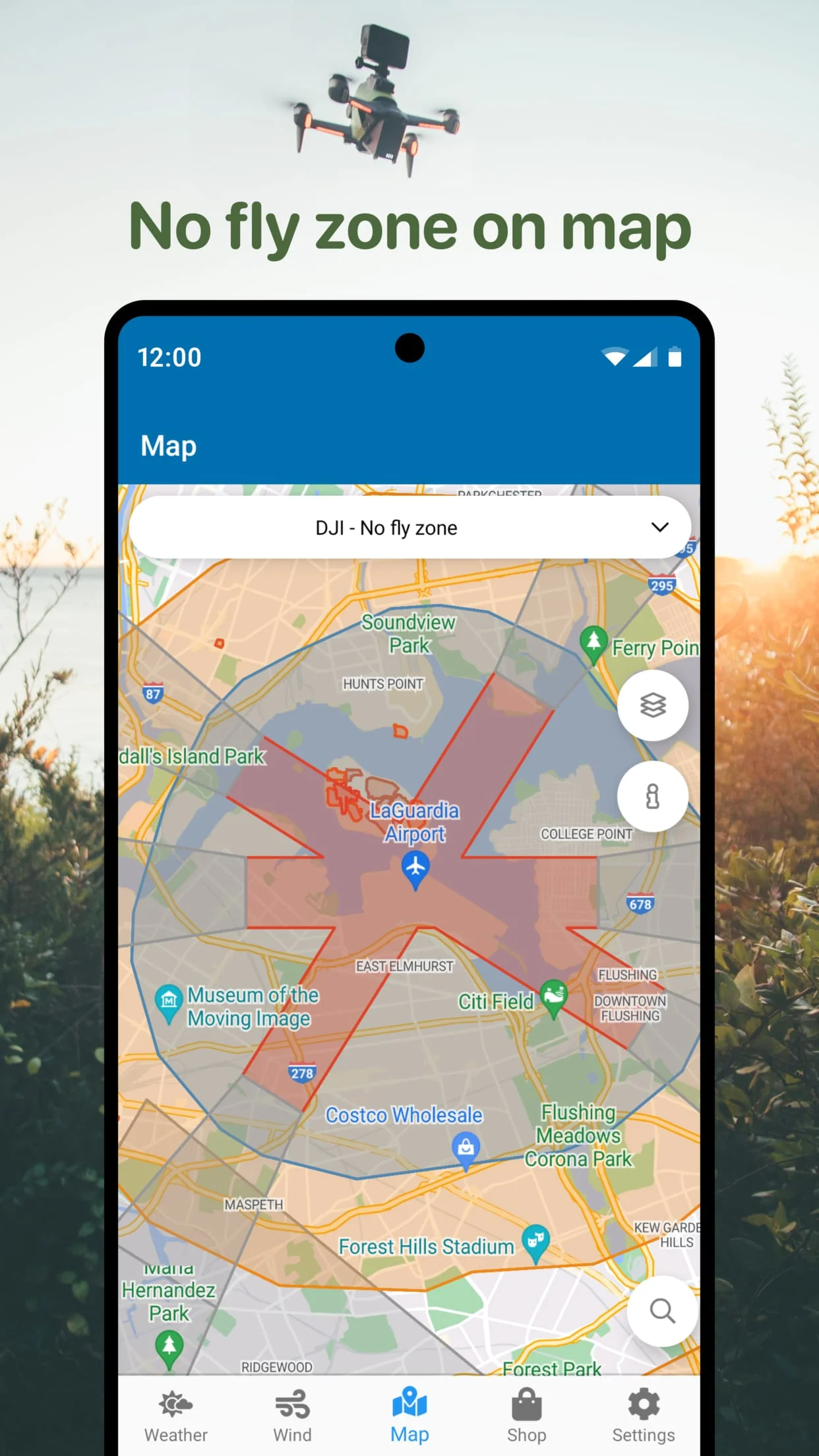
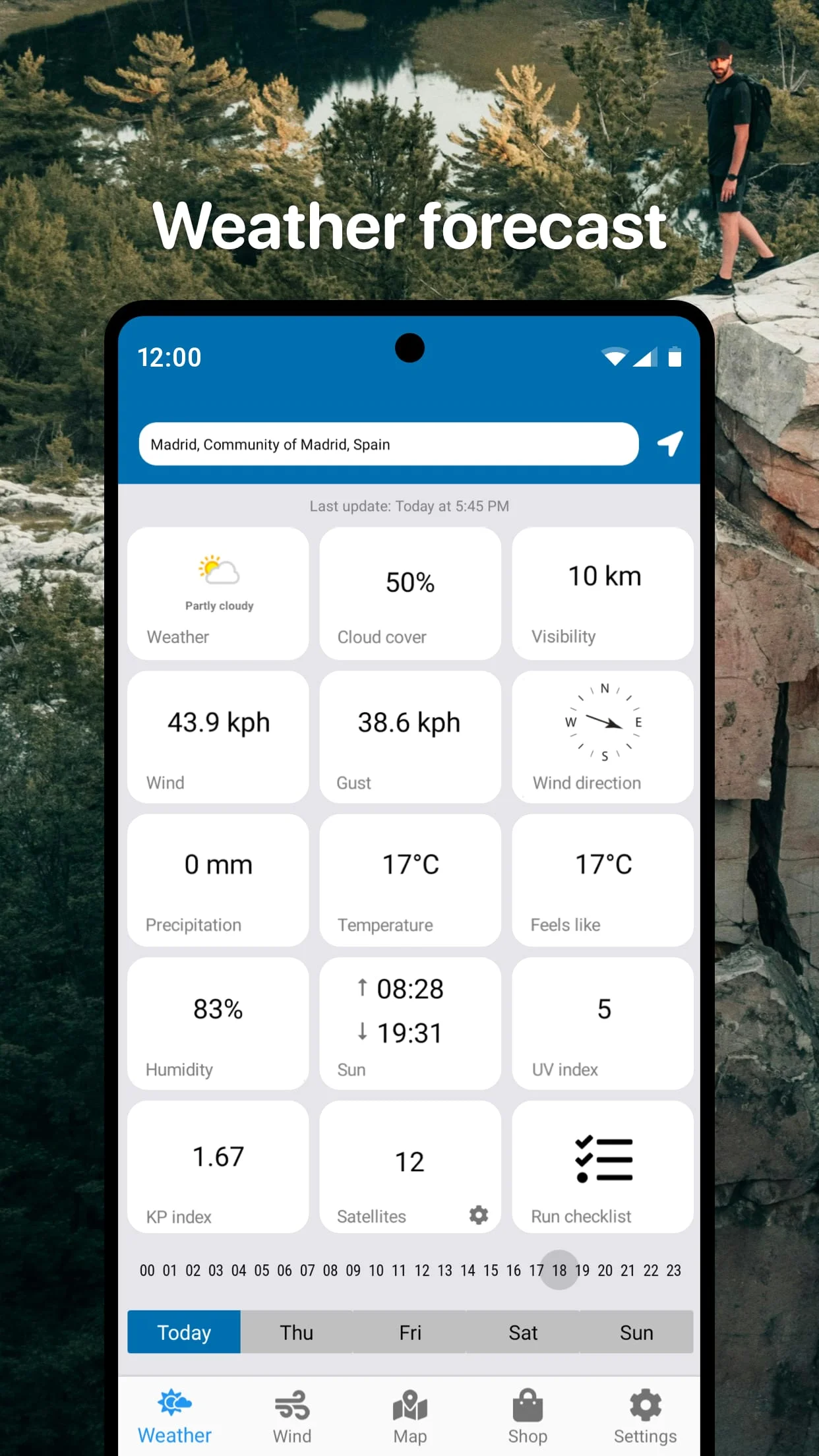
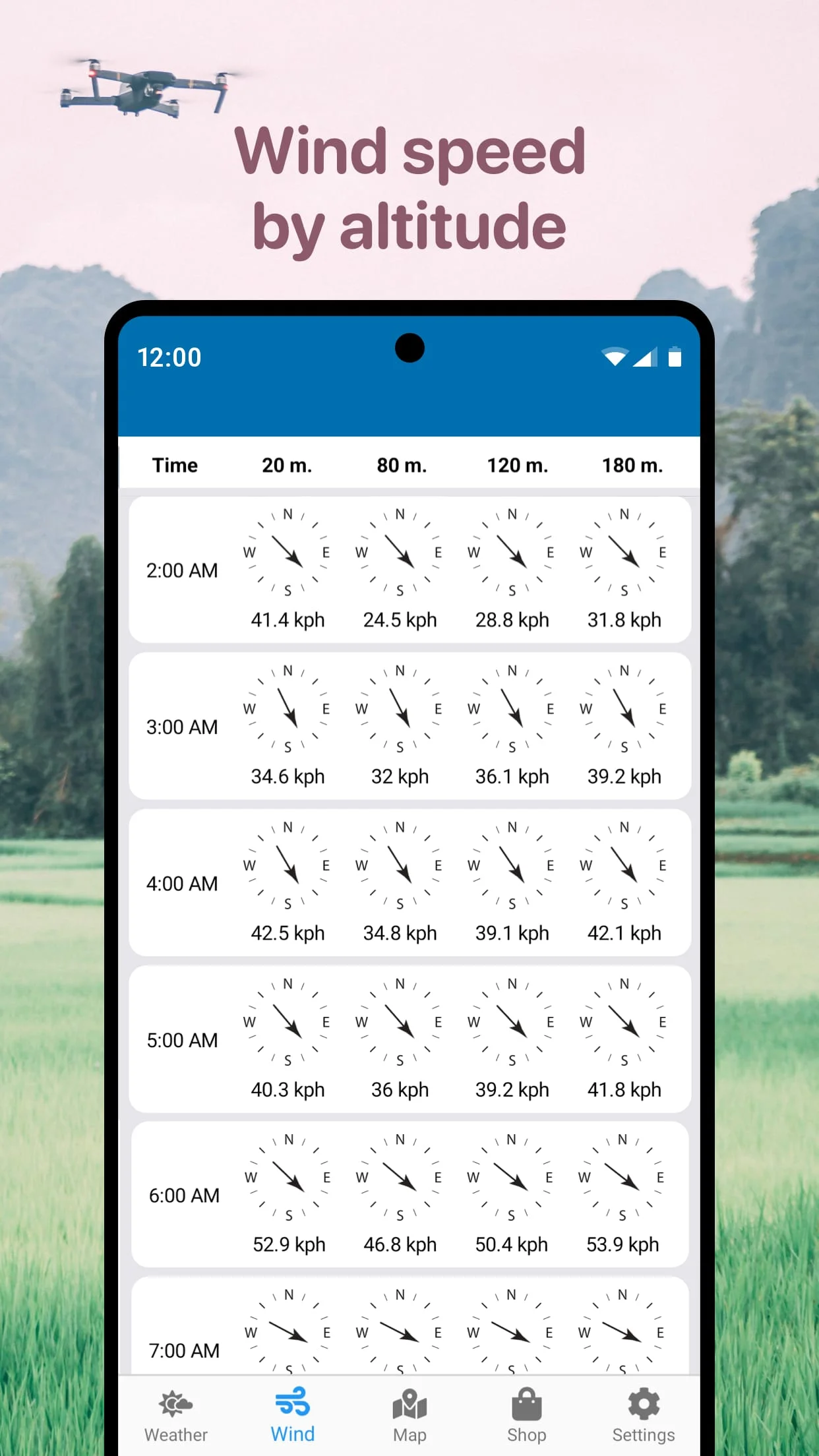
Drone Forecast is a mobile application designed for drone enthusiasts and professional pilots. The app provides detailed weather forecasts for selected areas, including wind speed, maximum gust, direction, and other useful parameters. With the app, you can plan your flights ahead of time, up to three days in advance, and fly your RC aircraft or drones safely. One of the app's most useful features is the No Fly Zone air map, which helps you find safe locations for your quadcopter flights. The map shows areas to avoid, such as airports, heliports, and other restricted zones marked in red. Additionally, the app includes a compass to detect wind direction, making it easier to navigate your drone in the air. Drone Forecast is a universal assist tool for drone pilots, compatible with a wide range of unmanned aerial vehicles (UAVs), including DJI Mavic, DJI Phantom, Inspire, DJI Mini, DJI Air, Spark, Parrot Bebop, Xiaomi, Autel, Walkera, Yuneec, Hubsan, FIMI, Syma, Volocopter, Skydio, and others. With all the necessary information in one app, Drone Forecast is a must-have for anyone who wants to fly their drone safely and responsibly. In conclusion, Drone Forecast is a comprehensive mobile application that provides drone pilots with all the necessary information to fly their drones safely. With detailed weather forecasts, a No Fly Zone air map, and compatibility with a wide range of UAVs, the app is a universal assist tool for drone enthusiasts and professional pilots alike. Whether you're flying a DJI Mavic or a Syma, Drone Forecast is an essential tool for planning and executing safe drone flights.
V1.3.1
Apr 1, 2024
com.drone.assist
Android 4.4+
Everyone
1M+
Developer
Go Dreams
View all apps
Statistics
42
Total Reviews
Intelligently Verified
AI-Powered Security Scan