About Map of NYC Subway - MTA
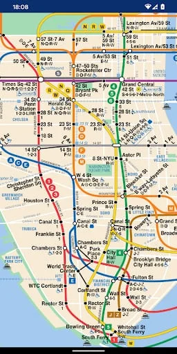
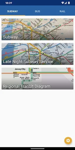
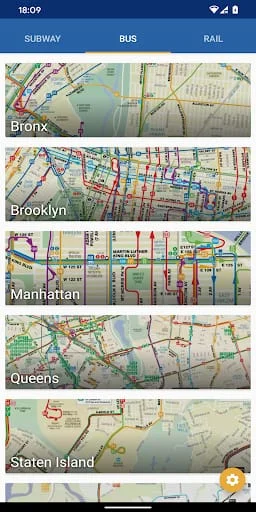
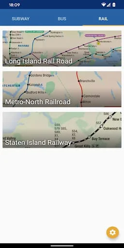
The Offline Line Maps for New York City (MTA) is a mobile application that provides a complete set of offline maps for NYC public transport. The app includes subway, bus, and rail maps from the MTA sources, making it an excellent tool for both visitors and permanent residents of New York City. With no internet connection required, users can zoom in, zoom out, and scroll around the maps with ease. The app includes a wide range of line maps, including the Subway System, Subway Late Night Service Map, Regional Transit Diagram, and bus maps for Bronx, Brooklyn, Manhattan, Queens, and Staten Island. Additionally, the app provides rail maps for Long Island Rail Road, Metro-North Railroad, and Staten Island Railway. The app also includes a city map and metro, subway, and underground maps. The Offline Line Maps for New York City (MTA) is a simple and easy-to-use app that provides users with all the necessary information to navigate the city's public transport system. The app is an excellent resource for visitors to the city who may not have access to the internet or want to avoid using their data plan. The app is also useful for permanent residents who want to plan their routes in advance or need to navigate unfamiliar areas of the city. The app is developed by indie developers, and users are encouraged to support them by providing feedback and reporting any problems they encounter. Overall, the Offline Line Maps for New York City (MTA) is a must-have app for anyone who wants to navigate the city's public transport system with ease.
V2.6.1
May 3, 2024
com.apptastic.nycsubwaymap
Android 4.4+
Everyone
100K+
Similar Apps
Developer
Apptastic Software
View all apps
Statistics
232
Total Reviews
Intelligently Verified
AI-Powered Security Scan