About Navionics® Boating
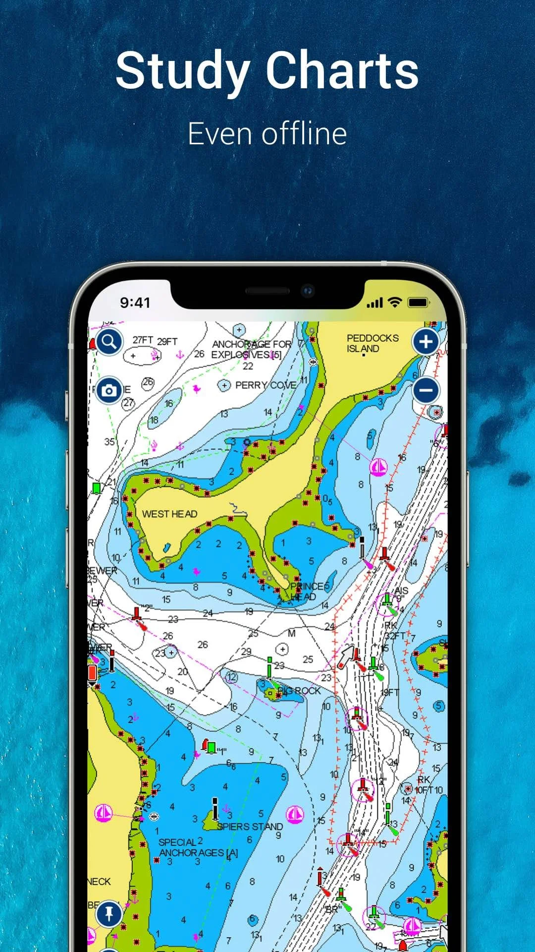
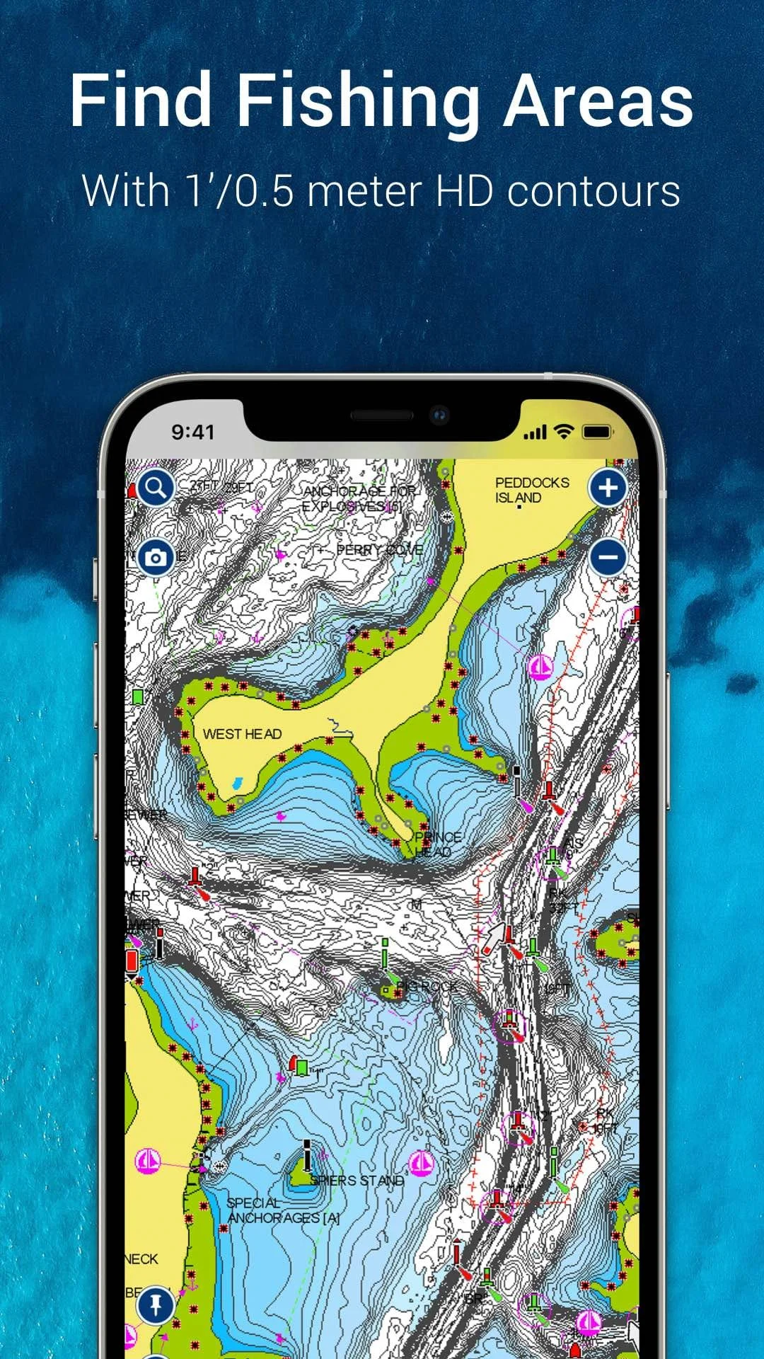
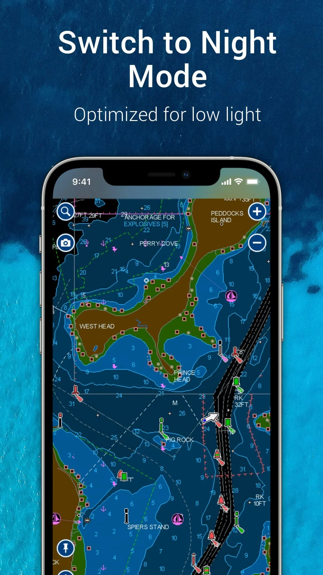
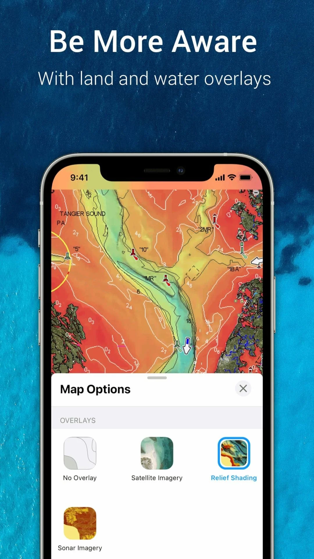
The Boating app is a comprehensive tool for anyone who enjoys activities on the water. It offers internationally renowned Navionics® charts that can be used offline, along with multiple overlays that provide a better understanding of what's above and below the water. The app also includes SonarChart™ HD bathymetry maps, U.S. government charts, and daily updates. Users can customize chart views, highlight shallow areas, and target multiple fishing ranges. In addition to its mapping features, the Boating app offers tools for planning and enjoying your day on the water. Auto Guidance+TM technology provides a suggested dock-to-dock path based on chart data and navigation aids, while real-time weather data, daily and hourly forecasts, and wind, weather buoys, tides, and currents help users plan for safe and enjoyable boating. Users can also place markers, record tracks, take photos and videos, and easily check distance among two points. The Boating app also includes an active and helpful community of fellow boaters. Users can obtain and contribute useful local knowledge through community edits and the ActiveCaptain® community, share their live location, tracks, routes, and markers with friends and fellow boaters, and share saved data outside the app or transfer it to their chartplotter. The app is compatible with external devices, including chartplotters, sonar/plotters, and AIS receivers with Wi-Fi® connectivity. Overall, the Boating app is a must-have for anyone who enjoys cruising, fishing, sailing, diving, and other activities on the water. Its comprehensive mapping features, tools for planning and enjoying your day, and active community make it an essential tool for boaters.
V22.1
Nov 27, 2024
it.navionics.singleAppMarineLakesHD
Android 4.4+
Everyone
5M+
Similar Apps
Statistics
2226
Total Reviews
Intelligently Verified
AI-Powered Security Scan