Live Earth Map - World Map 3D
About Live Earth Map - World Map 3D
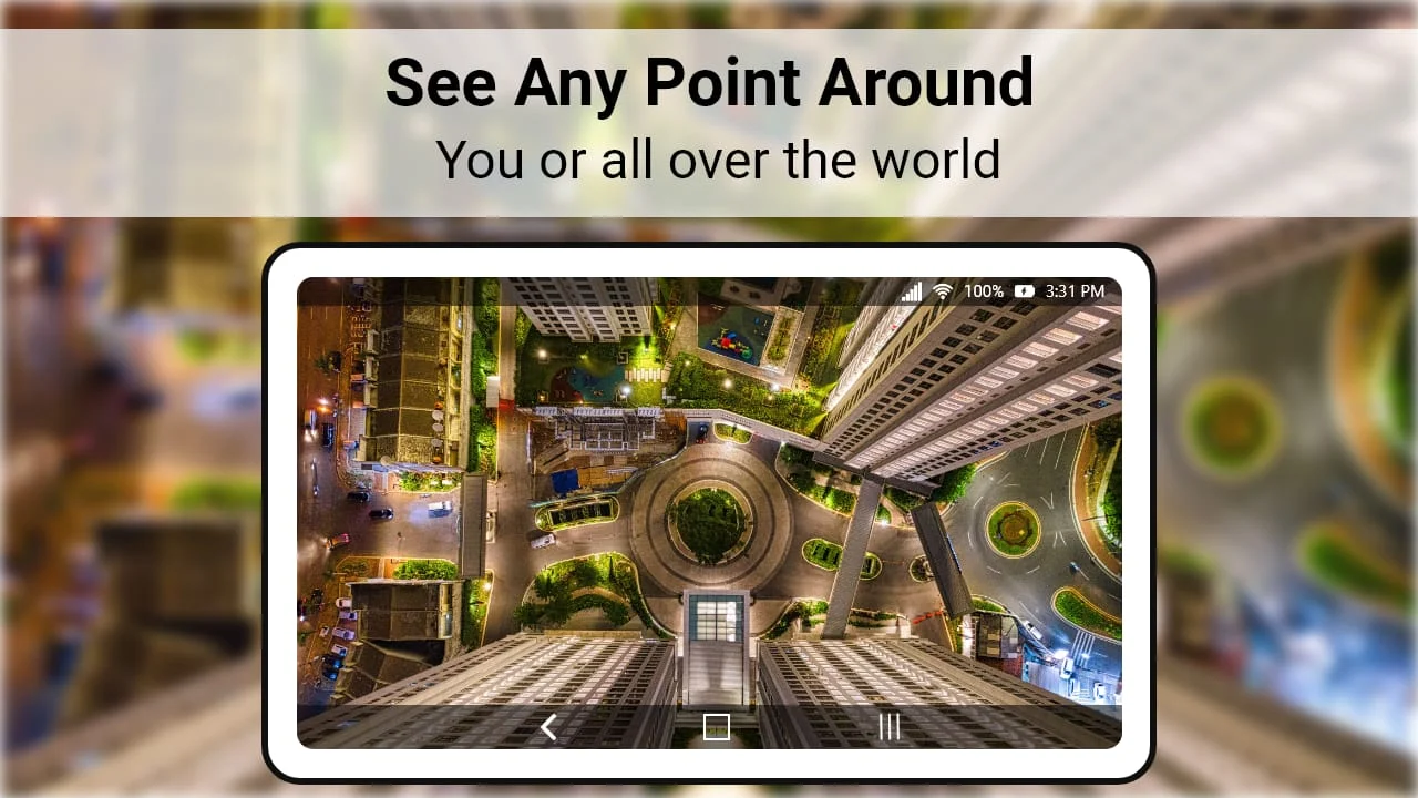
Live Earth Map - Satellite View, World Map 3D app is a free navigation tool that allows users to explore the world from above with live satellite view and 3D terrain of the entire globe. With this app, users can view 3D buildings in thousands of cities around the world and enjoy live street view 360 panoramas streaming. The app is designed to make trip planning easy and fast with live traffic maps and GPS navigation. Users can find their current location and plan their trips with live earth map 2019. The app also features a range of complete earth view live maps, live satellite real-time tours, and HD photos of famous locations. The Street View application is another feature of the Live Earth Map - Satellite View, World Map 3D app. It allows users to find invisible places with images taken with a 360 camera. The app uses a global positioning system to find the best driving route and enables users to search for nearby places such as ATMs, restaurants, railway stations, hospitals, airports, gyms, parks, and fuel stations. Users can get the best driving directions when driving a car and track with GPS Navigation accurately. The app also allows users to share their trip plans with their contact list. The Live Earth Map - Satellite View, World Map 3D app has several features that make it easy to use and navigate. The app has a friendly user interface and allows users to search for any location by name, street number, or city address. Users can also enjoy the view from space with the Satellite view Voyager view and see live satellite views images of their home and neighborhood map. The app is up to date with GPS world map 2019 and is available 24/7 for real-time exploration of the world. Overall, the Live Earth Map - Satellite View, World Map 3D app is a useful tool for anyone who wants to explore the world from above and plan their trips with ease. In conclusion, the Live Earth Map - Satellite View, World Map 3D app is a free navigation tool that allows users to explore the world from above with live satellite view and 3D terrain of the entire globe. The app features a range of complete earth view live maps, live satellite real-time tours, and HD photos of famous locations. The Street View application is another feature of the app that allows users to find invisible places with images taken with a 360 camera. The app is easy to use and navigate with a friendly user interface and allows users to search for any location by name, street number, or city address. Overall, the Live Earth Map - Satellite View, World Map 3D app is a useful tool for anyone who wants to explore the world from above and plan their trips with ease.
V1.4.0
Aug 29, 2023
com.live.earthmap.streetview.livecam
Android 4.4+
Everyone
5M+


Similar Apps
Statistics
588
Total Reviews
Intelligently Verified
AI-Powered Security Scan